Day 5 - Cropredy to Banbury
|
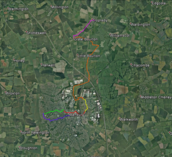
Click on each of the images for larger maps.
Close the larger maps by clicking on the white cross in the top right corner of the page. You can download a .kmz file for GPS or Google Earth from each route description section. Distances for each section and each day are shown at the bottom of the page. |
|
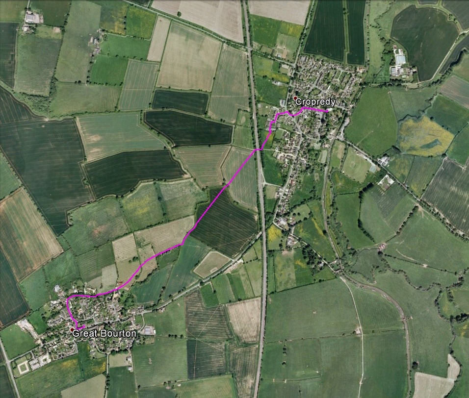
Part 31 - Cropredy to Great Bourton
Turn right out of church porch ad leave churchyard via the gate. Go down the road (CHURCH LANE) to HIGH STREET and turn left. Follow the right fork to the main road. Cross this and turn left into CUP AND SAUCER. Pass the remains of a stone cross (the cup and saucer) on the right and turn left, continuing to a small green (footpath sign Great Bourton 1). Cross to the far right-hand corner of the green (footpath sign) and continue along the path between houses turning left at the fence and then right to cross a footbridge (footpath marker) and go through a gate. Go ¼ right across the field to a stile and cross this into the trees. Continue leftwards through the trees to a stile and track. Turn right and follow the track underneath the railway bridge to a gate into a field on the left. Go through the gate and 1/3 right to a double-stiled footbridge (footpath marker) then 1/3 left across the next field towards its far left-hand corner. Go through a gap in the hedge (footpath marker) into the next field and along the hedge to your right for about 100 metres to a footbridge. Turn right across the bridge, go through a gate and continue with a stream on your left and a fence on your right, then between fences to reach a gate at a house to your left. Go through the gate and across to another footpath gate (footpath marker). Go through this and continue along the fence to your right, initially uphill, then down and up to steps and a stile. Cross this and turn right up the lane onto the roadway keeping left and curving leftwards up the hill to the top of STANWELL LANE, then continuing leftwards and following MANOR LANE left and then right to reach the bell tower and Great Bourton Church |
|
|
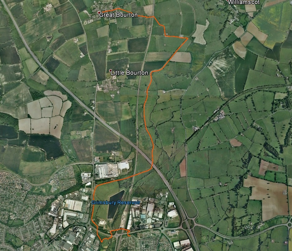
Part 32 - Great Bourton to Edge of Grimsbury
Leave the churchyard at its southwest corner, turn left along the main road and continue until you reach Crow Lane on the right of the road. Cross the stile at the junction of Crow Lane and the main road and go across the field aiming to the left of the trees ahead of you to the right to reach a gate. Go through this, continue diagonally rightwards to the hedge and cross a footbridge with stiles at either end. Do not cross the stile ahead of you into the next field but turn left and go down the grass track to a gate. Go through this and head slightly right to the hedge corner. Follow the hedge to reach the railway via a stile. Cross the line and go over a stile. Cross the field to meet the hedge a little before the far field corner, aiming at a point midway between the rightmost tree in the hedge and the corner. Cross the footbridge and stile and continue towards the double telegraph pole ahead of you. Go over the stiles just to the left of the telegraph pole and follow the right hand boundary hedge to a gate at the far side of the field. Go through (or climb over) the gate and turn left on the track. At the farm buildings cross a stile at a gate into a field on the right (PERMISSIVE FOOTPATH is on a marker on the stile). Turn left and go along the hedge past a gate to a further stile. Go over this, turn right and continue across the bridge over the canal. Go through the gate and turn right down onto the canal towpath via a stile with a marker indicating CROPREDY CIRCULAR WALK and steps. Turn left on the towpath which takes you to Grimsbury. Just beyond bridge 161A which carries the railway line you can go up steps into GRIMSBURY WOODLAND NATURE RESERVE and follow the path through the reserve which eventually brings you back to the towpath. Just before a sign on the towpath reading ‘Anglers Beware Overhead power cables’ turn left off the towpath and follow a path through trees to open ground on which is a pylon ahead of you. At the footpath post marked BANBURY FRINGE CIRCULAR WALK turn left and then at the WELCOME TO SPICEBALL PARK sign turn left onto the pedestrian/cycle track. Go over the stream and under the road. Keep on the track as it passes the car park and at another WELCOME TO SPICEBALL PARK sign turn right (there is also a footpath sign TO OXFORD CANAL 1/4). Pass Grimsbury reservoir on the left, continue across a road junction and over the bridge over the railway. Follow the road down and round a right hand bend where the road becomes a pedestrian/cycle track. Pass through BOTTILER SUBWAY into Grimsbury. |
|
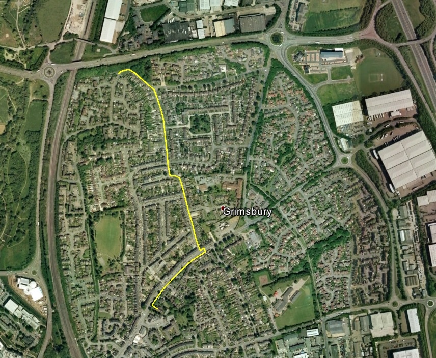
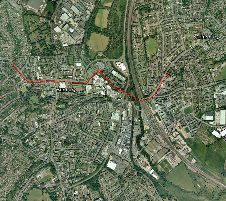
Part 33 - Edge of Grimsbury to Banbury St Leonard's
From Bottiler Subway go leftwards on the cycle/pedestrian track to the road, cross it, turn left and go round the right-hand bend to the mini-roundabout. At the roundabout, leaving Grimsbury Green take the right turn (signed Town Centre) pass MANOR COURT on the right and as the road turns left go straight on past GIBBS ROAD on the right to OLD GRIMSBURY ROAD. Turn right along this and turn left into WEST STREET. Continue on West Street, passing GRIMSBURY METHODIST CHURCH on your right, until you reach the junction with the main road (MIDDLETON ROAD) at a mini-roundabout. Turn left to the pelican crossing and cross the road to reach St Leonard’s Church. |
|
|
Part 34 - Banbury St Leonard's to Banbury St Paul's
From St Leonard’s return to the main road, turn left and cross at the pelican crossing. Turn left and continue across WEST STREET and WATERLOO DRIVE and follow the road as it bends right over the railway. Just after a sign on your right WELCOME TO BRIDGE STREET PARK and opposite the entrance to the railway station on your left, turn right and follow the path down and then round to the left. Take the left fork to the canal (signed Town Centre, Oxford Canal (North)). At the canal go under the road bridge (bridge 165a). Go past bridge 165 and continue along the canal side (signed Sports Centre, Museum). Pass bridge 164 and then TOOLEY’S BOATYARD on the far side of the canal. Continue towards the next bridge, turning right off the canal a little before the bridge and going round left onto the ramp to cross it. Go down the steps on the far side and continue on to the main road between buildings with the multi-storey car park to your right. At the roundabout go left and cross the road leading to CASTLE QUAY DELIVERY AREAS 3 AND 4. Turn right along the railing and follow the road (signed WARMINGTON (B 4100), etc.) to the pelican crossing. Cross the road, turn left and continue to the crossroads and traffic lights ahead. Cross and continue straight on (you are now in the Warwick Road) past BANBURY COURTHOUSE and POLICE STATION to your right and follow the road round a right-hand bend to reach St Paul’s Church after passing BELGRAVE CRESCENT on the left-hand side of the road. |
|
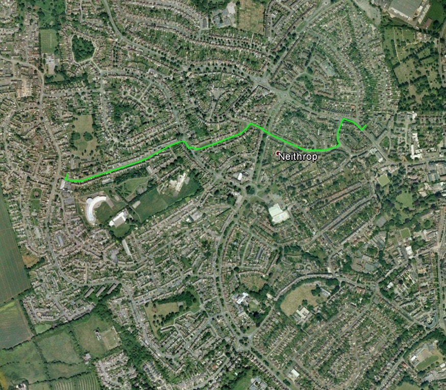
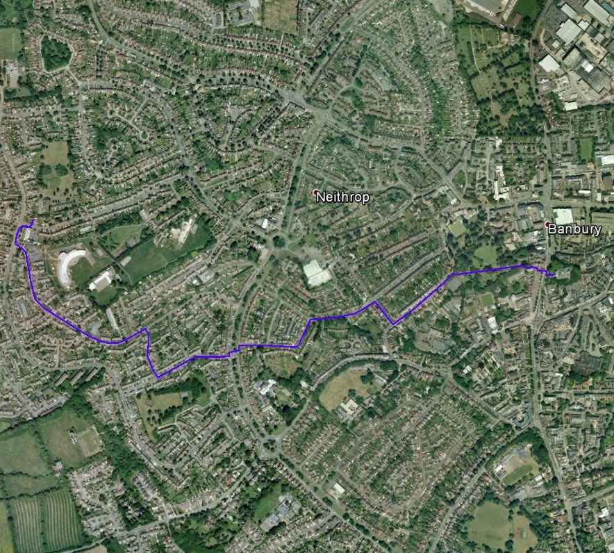
Part 35 - Banbury St Paul's to St Paul's Church Centre, Prestcott Avenue
Coming out of St Paul’s Church, turn right along WARWICK ROAD. After NEITHROP AVENUE on your right cross WARWICK ROAD and go up UNION STREET (left off WARWICK ROAD). Go up UNION STREET and take the first turning right up TOWNSEND (road sign obscured) which becomes WIMBORNE AVENUE. At the end of Wimborne Avenue cross over ORCHARD WAY into BEESLEY ROAD and continue to MILLER ROAD, the first turn left. Follow MILLER ROAD to THE FAIRWAY. Turn right along THE FAIRWAY and cross to take the first turning left into PRESTCOTT AVENUE. Continue up PRESTCOTT AVENUE to reach St Paul’s Church Centre on the right hand side near the top of the road. |
|
|
Part 36 - St Paul's Church Centre, Prestcott Avenue to Banbury St Mary's
From the Church Centre go out into PRESTCOTT AVENUE and turn right to reach BRETCH HILL. Turn left along BRETCH HILL and then first left into EDMUNDS ROAD. Passing the Church of St Joseph the Worker on your left continue to LIDSEY ROAD on your right and turn down this to reach MASCORD ROAD. Turn left along MASCORD ROAD to reach WOODGREEN AVENUE. Turn left and almost immediately cross WOODGREEN AVENUE. Turn left and then right down DEACON WAY. Follow this round a left-hand bend to reach GILLETT ROAD. Turn right at GILLETT ROAD and continue to PARK ROAD. Turn right along PARK ROAD and then left into BATH ROAD. Continue along BATH ROAD and as it curves left turn right into People’s Park. Go across the Park on the leftward of two paths. Leave the Park by an alley (THE LEYS) to emerge opposite St Mary’s Church. Cross HORSE FAIR by the pelican crossing to reach the church. |
| Section | From | To | Distance | Day Total |
|---|---|---|---|---|
| 31 | Cropredy | Great Bourton | 1.31 | 1.31 |
| 32 | Great Bourton | Edge of Grimsbury | 4.52 | 5.83 |
| 33 | Edge of Grimsbury | Banbury, St Leonard's | 0.64 | 6.47 |
| 34 | Banbury, St Leonard's | Banbury, St Paul's | 1.14 | 7.61 |
| 35 | Banbury, St Paul's | Prescott Avenue Church Centre | 0.97 | 8.58 |
| 36 | Prescott Avenue Church Centre | Banbury, St Mary's | 1.47 | 10.05 |
